|
|
|
The Outer Banks are a popular vacation destination in the southeastern
United States. Somewhat remote because of limited access, this
130-mile-long stretch of narrow islands sits off the mainland of North
Carolina, bordered by the Currituck, Albemarle, and Pamlico Sounds to the
west and the Atlantic Ocean to the east. Surfers, windsurfers, and
avid kite enthusiasts converge on the islands for some of the best waves
and wind on the East Coast. However, the unique combination of
natural forces at work here also contributes to often-dangerous seas and
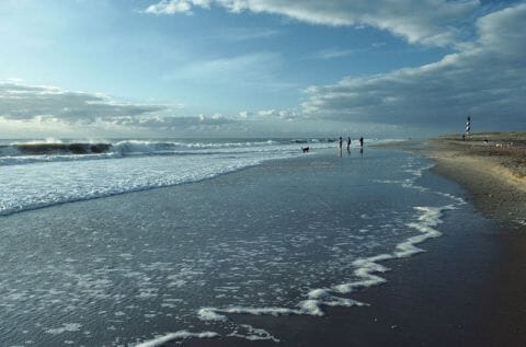
devastating hurricanes. The Cape Hatteras Lighthouse, the tallest
in the United States, has surely saved countless ships from destruction
along this treacherous stretch of coastline. Still, thousands of
shipwrecks litter the seabed along the Outer Banks, earning it the
nickname "Graveyard of the Atlantic."

Cape Hatteras Beach
• North Carolina - Find travel information, maps, tourist resources, and more photos of North Carolina.
• Cape Hatteras National Seashore - Learn about this North Carolina park at the National Park Service website.
Copyright © 2006-2025 Zeducorp.
All rights reserved.
Outer Banks
|
